The Dartmoor Way
Recently I walked the Dartmoor Way as my route for the Long Distance Walkers Association Virtual 100 mile event. The Dartmoor Way is actually 108 miles long (and has 16,500 ft of ascent apparently), so I started at Bovey Tracey and walked anti-clockwise to just beyond Ashburton. Some stretches were already known to me, but I walked most of the walk in 20 mile sections ahead of the event to make sure there were no nasty surprises. The more I walked it the more impressed I was.
The Dartmoor way has been around for some years as a named walking trail and as a cycling variant, but signage had deteriorated and Ordnance Survey were threatening to remove it from their mapping so a project officer (Mike Owen) was appointed to re-sign the route and update it where needed. The route has a website https://www.dartmoorway.co.uk/ and on it you can find maps at 1:50000 scale, Gpx routes and word/pdf route sheets. I recommend the later, because the route description has been interspersed with excellent historical information about the major points of interest you will see along the way, and will greatly enhance your experience of the walk.
Route descriptions start from Ivybridge, going anti-clockwise, Ivybridge being the only point where the mainline railway offers access to the route. However at the time of writing a branchline service from Exeter to Okehampton is soon to be initiated, so it will be possible to do half the route starting and finishing at a railway station. Ivybridge is also one of the better towns in regard to bus services, though we found that buses could be used to access and link up many sections of the route. The route is written in 11 convenient sections, each starting and finishing in a town where transport, food and accommodation can be obtained, each section being 8-12 miles in length. So you can spend a fortnight at it in easy stages, push through it in 5-6 20 mile+ days or, the ultimate madness, walk it all in one go over 40 hours like I did!
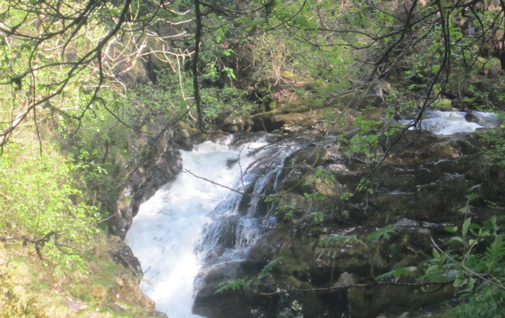
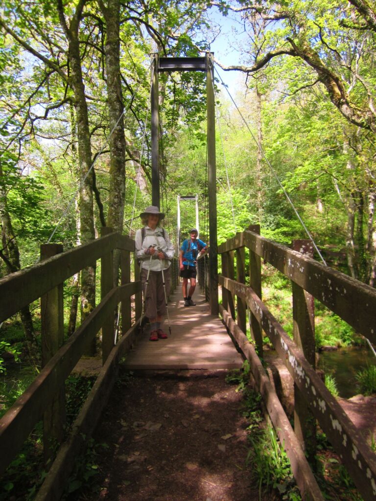
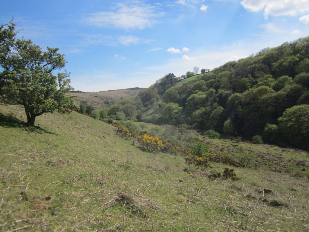
So what is the route like? Well it doesn’t really penetrate the high moor, but instead links all the towns and villages around the outer perimeter. In doing so you get a lot of variety (and a lot of ascent and descent). You will experience delightful woodland (at their best in late May when the bluebells are out) cut by lively rivers, you will walk railway track beds, cross pasture fields (and the rare arable one), you will pass industrial archaeology, walk on the balcony route above the Teign gorge, pass clay quarries of vast dimensions, cross golf courses, descend beside waterfalls and be treated to numerous excellent views of the high moor to your left. There will be some stretches of road, but they won’t be busy and are often as scenic as the rest of the walk.
The waymarking has been done well, but already some rotting signposts and gates have been replaced, so inevitably the waymarking is beginning to suffer in some places, but it’s rare you can’t follow it except on the open moor where there is no waymarking. Skill in map and compass are not really a necessity as in bad weather alternatives are suggested and you can usually handrail a linear feature if needed, but being able to map read may enhance your enjoyment and should be an aspiration for anyone venturing onto the high moor. Using the Gpx files on a Gps device will also help get you out of trouble.
The highlights for me were numerous, the whole stretch from Mortonhampstead to Chagford is particularly special, as is the section between South Zeal and Okehampton via Belstone. In both cases its the woodland gorges that really make them. Walking from Bovey Tracey through Water to Foxworthy en route to North Bovey is pretty good too, as is the valley floor path beside the Walkham near Grenofen, although this last has a lot of tree roots to keep you on your toes. There is a pleasant stretch approaching Shaugh bridge from Godameavy and it continues with stunning views of Dewerstone as you walk the pipeline path to Cadover, and of course the open moor stretches either side of Shipley bridge are always enjoyable.
So do I recommend it? Resoundingly Yes, both as an entire route and as a number of long days out. At Hillwise guided walks are our business, so if you aren’t sure about your abilities we would be happy to talk about guiding you around the route and may even be able to arrange baggage transfers if for a group.